The arches carry something small
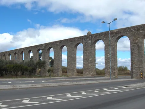
The Água de Prata Aqueduct brought water from the countryside into Évora, Portugal, in the sixteenth century. Its long line of arches is the conspicuous part of a supply system extending roughly eighteen kilometres towards the Divor area. The water itself travelled in a much smaller channel carried above the ground.
Francisco de Arruda directed the major Renaissance building works. Water reached the city in 1537. Although Évora also had Roman water infrastructure, the standing Água de Prata system should not be described simply as a surviving Roman aqueduct.
Look along a run of arches rather than at one pier. The structure was built to maintain the water's course across changing ground. Its repeated shape is a practical answer to the terrain, with a scale that makes an everyday need visible across the city.
A supply line, not just a landmark
An aqueduct has to connect a source with places where people can use water. Thinking about that connection changes the view of the arches. They are one stretch of a much longer system, not a monument whose purpose ended at its most photogenic point.
The city's fountains and distribution structures help complete the story. Municipal research identifies water boxes used for airing, settling and access, as well as fountains supplied by the aqueduct. Some components were moved or removed as streets and squares changed.
That is why an old water system can be difficult to read from one position. A missing terminal feature does not mean the channel originally stopped at the next visible arch. It means that the infrastructure and the urban space around it have been altered over time.
Water enters the public square
Praça do Giraldo's fountain belongs to this urban history. The present sixteenth-century fountain replaced an earlier arrangement that received the aqueduct's water. You do not have to visit every part of the system to see the difference between carrying water over a valley and making it available within the city.
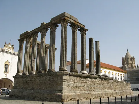
The arches also invite comparison with Évora's Roman Temple. Both use repeated stone supports, but their jobs were different. The temple organised a sacred public building. The aqueduct carried a service across the landscape. A shared impression of antiquity can hide centuries between them.
Use the map pin as a reference for the standing structure, not as the start of a marked walk along its full length. Streets, crossings and access vary. Where you can view the arches from a public space, follow their height against the surrounding ground and imagine the modest water channel they were built to support.